Project News ·
Citizen Science project wrap: Stories of impact
Community seagrass mapping and data visualisation
Impact Summary (Project funded mid-2019 and wrapped mid-2021)
Science Under Sail Australia trialled an approach to address a knowledge gap in seagrass spatial extent on the GBR by training high school students along the coast to collect and share rapid spatial assessments of seagrass through day trips and multi-day field expeditions. Students helped collect seagrass data at more than 3,500 locations across approximately 40,000 km2 of the Great Barrier Reef World Heritage Area (GBRWHA), from Cairns to the Capricorn Bunker group at the southern end of the Reef. This is the first time a citizen science program has collected detailed seagrass habitat data from such a large area of the Reef. Through the experience students learned about scientific methods, leadership and for some it was a spark for a further interest in marine science and conservation – helping to build our next generation of Reef champions.
Projet Impact Story
Seagrass is a critical habitat in the diverse matrix of the Great Barrier Reef, helping to support its diverse ecosystem services, including sequester carbon and providing food resources for iconic species such as turtles and dugong. While there is detailed long-term monitoring of seagrass condition at key locations along the Queensland coast, the lack of recent spatial data in many regions was identified as a knowledge gap by the seagrass expert panel to RIMReP. This lack of understanding of the current spatial extent of seagrass across the GBR limits appropriate management of this critical environmental asset.
This project trialled an approach to address that gap, by engaging 247 Queensland students in two seasons of rapid spatial assessment of shallow and subtidal seagrass at over 3,500 locations from Michaelmas Cay (off Cairns) in the north, to the remote Capricorn Bunker Group in the south. Activities collected the first observations since the 1970s for seagrass in many regions of the reef and demonstrated that a supervised citizen science approach for benthic habitat surveys can provide a cost-effective way to collect data on the condition and distribution of seagrass as well as other critical habitats (e.g. coral) within the GBR World Heritage Area.
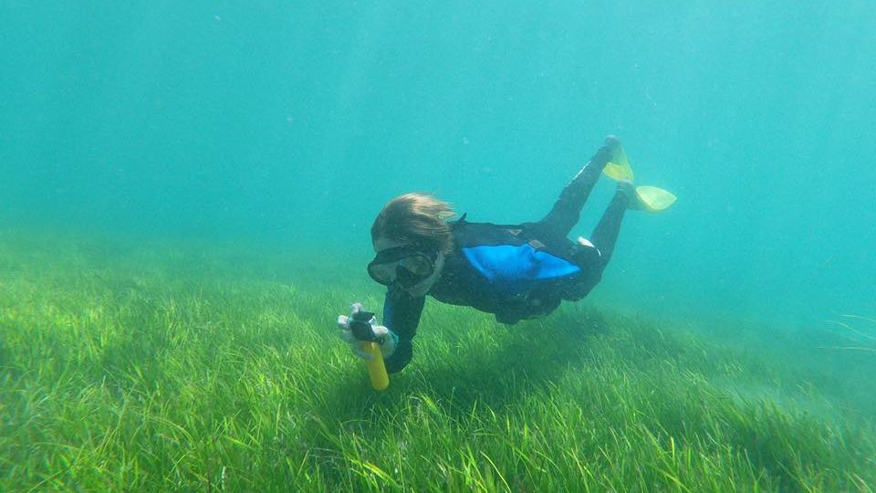
Students in the field practicing seagrass assessments. Credit: Science Under Sail.
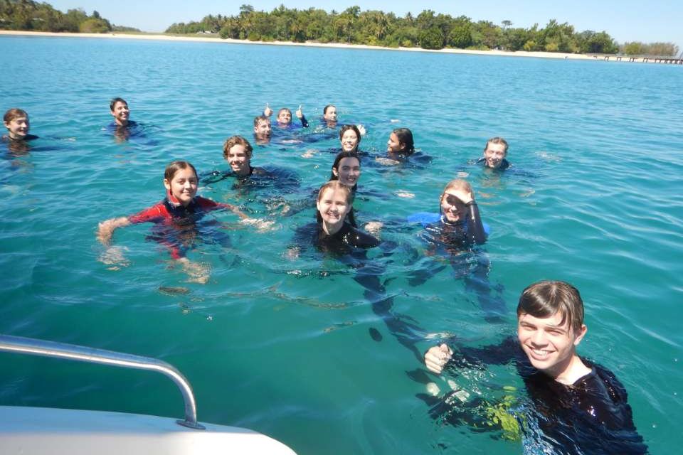
Activities in 2019 focused on running single day and multi-day school excursion fieldtrips, collecting information on the condition of benthic habitats adjacent to the school’s location. Beyond collecting data, the field work provided students with a better understanding of place and the pressures the GBR is experiencing. Students from 7 schools adjoining the GBRWHA participated in our program in addition to several students from other parts of Australia. Surveys were conducted along 1,000km of the GBR coast (Cairns to Bundaberg) and up to 70km off the coast in the Capricorn Bunker group.
In 2020, the project adapted to new Covid-safe requirements by reducing the number of students on the boat, and adding a digital storytelling component to connect with schools. The project also engaged directly with students in the classroom at host schools by participating in a virtual classroom experience during scheduled science classes.
While fewer students had the opportunity to get out in the field, the digital engagement pathway boosted engagement and increased the number of people the project reached, resulting in a 40-fold increase in reach and engagements. More than 30 digital stories produced through this project were viewed by over 200,000 people, with most of those views occurring due to the change in strategy in 2020 (on Facebook, Instagram and YouTube).
Filed work summary video from 2020 season. Credit: Science Under Sail Australia.
Engaging school students in citizen science offered an opportunity to improve data science skills, build leadership capacity and grow motivation for students to get involved in marine science and conservation. In a field expedition near Orpheus Island, 12 students from St Teresa’s Abergowrie school conducted surveys of coral and seagrass.
"One of the lasting benefits of the day came from the enthusiasm and interest the students showed when it came to learning about the ecology of the reef, pressures it is currently experiencing and ways they could get involved to help its future.
Dr James Udy, Director of Science Under Sail Australia
Students also showed enthusiasm for learning more about the reefs ecosystems when they returned to school. One student expressed an interest in learning more about marine science – leading to the establishment of an internship program to provide marine science mentoring and work experience to select students."
From the involvement with Science Under Sail Australia, St Teresa’s Abergowrie School expressed an interest to continue educational collaborations to empower the next generation of Indigenous custodians to build science knowledge to help explore connections between traditional and western management strategies for the Reef.
"The Science Undersail Trip was an amazing experience. We learnt so much about the Great Barrier Reef and it gave us an insight on how to analyse and collect data"
Student participants from seagrass field trips
"It was awesome, a great experience of learning about the reef, the health of different organism in the reef and how they all interact. It was great to see into the life of a marine biologist in the fields of not just seagrass but coral as well."
"The hands-on work we get to do and the real life opportunities provided made this trip special."
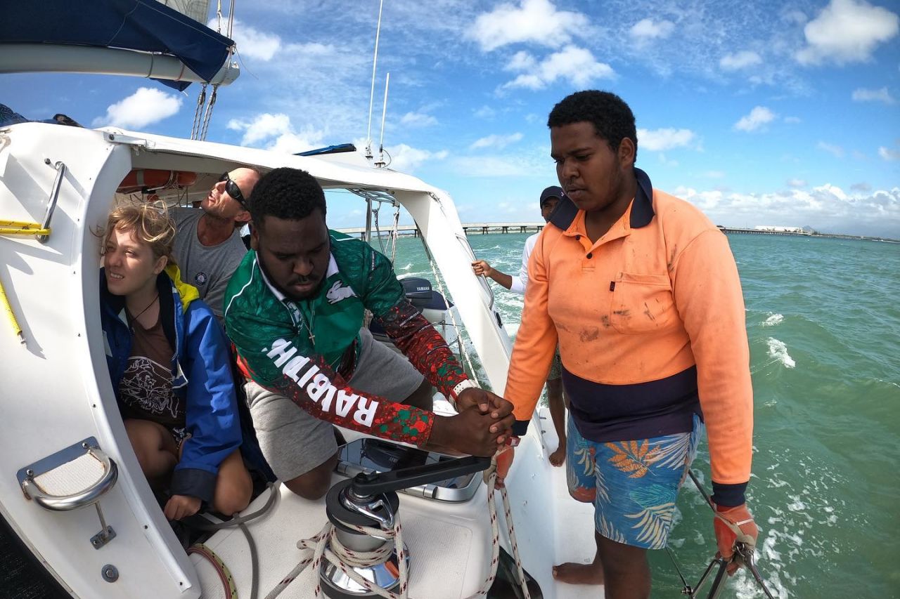
Students from St Teresa’s Abergowrie School practicing sailing skills near near Orpheus Island. Credit: Science Under Sail Australia
Teachers are also seeing the value in the chance to get students out for real-life experiences.
“Since our initial involvement, we have seen a significant increase in student interest in Science & Sustainability subject areas as they discover the real-world application of scientific data and how important scientific data and testing is to making decisions about Reef management.”
Amanda Kelk at Bundaberg Christian College
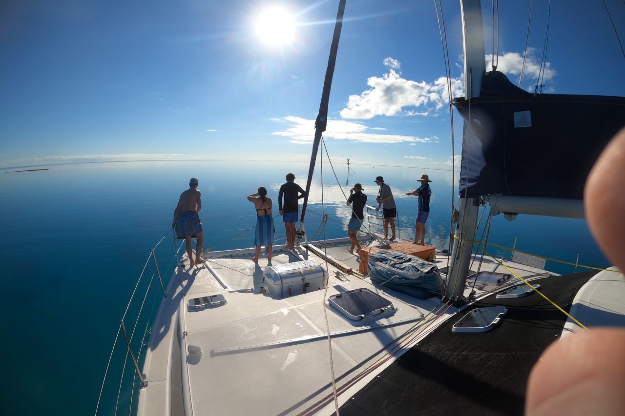
Students in the field on a glass-out day off of Bundaberg. Credit: Science Under Sail Australia.
Data collected through the project is available through the Australian Data Science Education Initiative (ADSEI) website. Teachers and students can download the seagrass data, with enough information to use the data in the context of Marine Science, Geography, Digital Technologies, Science, or Maths classes from year 9 to year 12, in Queensland or around Australia.
Science Under Sail continues to engage new schools interested in participating in future programs, as well as establishing a ‘SUSA Alumni network’ of past students to provide ongoing support, contacts and encouragement for students from different schools and sections of the GBRWHA to remain engaged in activities that support the GBR to be resilient and sustainable to benefit future generations.
Science Under Sail Australia's Community seagrass mapping and data visualisation (2019-2021) was funded by the partnership between the Australian Government’s Reef Trust and the Great Barrier Reef Foundation with support from the Australian Data Science Education Initiative.
#Related

Project News ·
Community at the forefront of Reef water quality protection

Project News ·
